
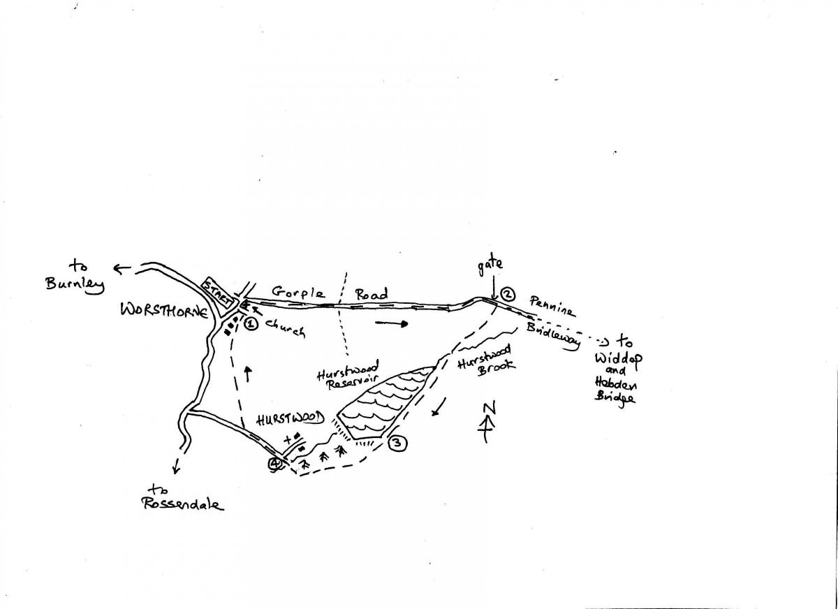
LANCASHIRE virtually ends at Worsthorne. Head east from this village and in just a few miles across Pennine moors you cross the county boundary and enter Yorkshire by the lonely reservoir at Widdop.
This walk follows a section of the old cross-Pennine packhorse road that still links Burnley with Hebden Bridge, passing along the way the now abandoned farming community at Gorple.
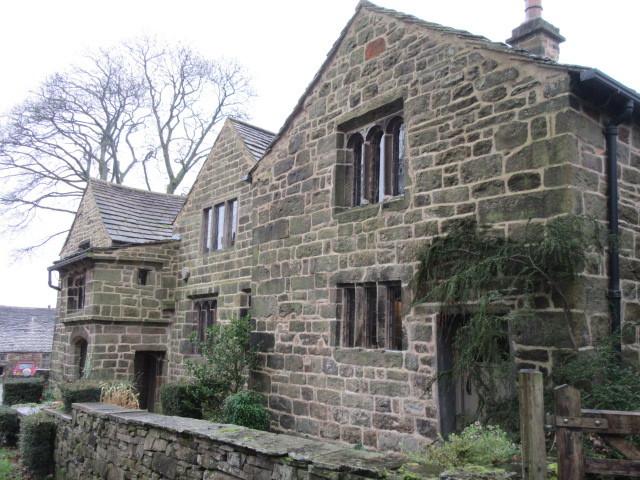
The walk also visits the little hamlet of Hurstwood, where brooks meet to form Burnley’s river, the Brun, and where the great Elizabethan poet, Edmund Spenser, lived for a time in the 1670s.
This area of moorland on the edge of town is a popular area with walkers and cyclists as the long distance routes of the Pennine Bridleway and the Burnley Way cross the moors here.
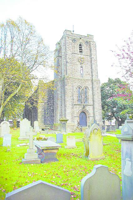
1. Start by St John the Evangelist Church. Facing the church join Gorple Road on the immediate left hand side of it. This is signed for Gorple. Follow the pavement past cottages and the road climbs gradually uphill becoming a rougher track between stone walls and open country.
This old packhorse road is followed straight ahead for over one mile heading for the Pennine moors and giving good views back across industrial East Lancashire.
The track eventually reaches a gate on the hillside above the steep-sided clough formed by Hurstwood Brook, a tributary of the River Brun.
2. After the gate turn immediately right down the waymarked track. It drops downhill into the clough and crosses the brook, continuing along the left hand side of the little valley leading to Hurstwood Reservoir. Simply follow the track along the left hand side of the reservoir until you reach a gateway to the left of the dam.
3. Cross the drain and continue straight ahead downhill through trees. The track passes a picnic area and car park on the left. Follow the main track which swings right to cross a bridge over the stream and arrive at the little hamlet of Hurstwood. Turn right to explore the hamlet which has a church and Elizabethan and Tudor buildings.
4. To continue the walk retrace your steps back to the bridge and phone box and continue straight ahead along the main lane leading out of the hamlet. Shortly after the houses end on the right look out for a signed footpath on the same side beginning at a gate and stile.
This keeps a wall side on the right and crosses stiles over several fields. The well-used field path heads in the direction of Worsthorne’s church tower. The field path reaches the backs of houses and continues straight ahead running behind the houses to the left.
The path emerges on the lane by the side of the church. Turn left to reach the front of the church.


Comments: Our rules
We want our comments to be a lively and valuable part of our community - a place where readers can debate and engage with the most important local issues. The ability to comment on our stories is a privilege, not a right, however, and that privilege may be withdrawn if it is abused or misused.
Please report any comments that break our rules.
Read the rules here