
FLOOD warning services should be improved, extended, or introduced in several areas of Bolton, a new report has said.
The recommendation came as part of a full review into the devastating impact of the Boxing Day floods, published yesterday, which revealed that some affected families are still living in temporary accommodation.
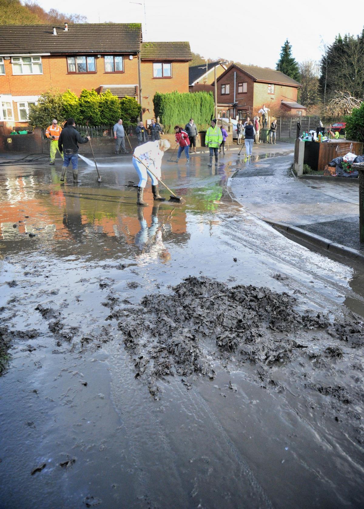
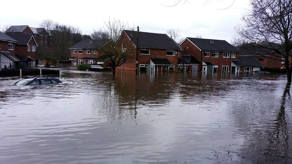
In Bolton, 116 properties were flooded, 57 of them in the Prestolee and Stoneclough area, where water inside homes reached head height.
There were also clusters of flooding in Lostock, Horwich, Darcy Lever and Smithills.
The report recommends re-assessing the available flood warning services in Prestolee, Stoneclough, Lostock, Smithills, Horwich, and Darcy Lever.
Other Bolton-specific actions identified include repairing collapsed culverts, footbridges and river walls, and pursuing riparian landowners to fulfil their statutory responsibilities.
In Prestolee and Stoneclough, sand and gravel will be moved to smooth the flow of the river.
Environment Agency officials are currently working with the Woodlands Trust to see whether tree planting proposals in Smithills could reduce flood risk.
Consultants have also been engaged to investigate possible improvements to the design of a debris screen in Bessy Brook, Lostock.
More than 2,250 homes and 500 businesses in the region were flooded, more than 31,200 properties lost their power supplies, and damage to infrastructure totalled £11.5 million after Storm Eva brought unprecedented rainfall last December.
The report, published by the Greater Manchester Combined Authority (GMCA), said that flooded residents in Bolton were still feeling the impact of the traumatic events.
It said: “Detrimental social impacts are still being felt by people in the borough, due to ongoing temporary accommodation, flood damage to homes, road collapses and closures, stress, community breakdown and substantial damage to recreational open spaces and facilities.”
Tony Lloyd, Mayor of Greater Manchester, said: “This report demonstrates the importance of working together across GM to solve our common problems.
“Last December, Greater Manchester agencies and communities came together magnificently to assist residents and defend property across the region from unprecedented flooding.
“Now, we’re working together again to understand the floods and ensure that we are better equipped to deal with future incidents.”
In Kearsley, river levels of 6.33m were recorded on Boxing Day, which is 1.6m higher than any other reading since records began 13 years ago.
A temporary pipe route has been installed while repair work continues on a collapsed pipe bridge at Kearsley pumping station. Damage was also sustained to Prestolee pumping station during the floods. As a result of the flooding, Bolton Council identified four blocked or collapsed culverts that posed significant flood risks or land drainage problems, two of which have now been repaired.
Damage to some of the 13 bridges and 300m of riverside footpaths across Bolton have been repaired, but some areas still remain closed for health and safety reasons.
Inspections and surveys of slips and erosion, training wall damage and highway damage have commenced and are still under way.
In total, the detailed investigations have been launched at 34 locations across Bolton to identify the cause of the flooding, required repair works and possible actions to reduce future flood risk.
The report adds: “The extreme rainfall and widespread flooding on Boxing Day caused devastation to many communities.
The flooding mechanisms were complex involving multiple sources of flooding.
“The majority of the flooding was caused by main rivers, but hundreds more properties were affected by flooding from other sources such as surface water, ordinary watercourses, sewers and ground water.
A number of Risk Management Authorities (RMAs) and responders worked together in the incident response and recovery phase to support affected communities. The RMAs have continued to work together and share information to produce this flood investigation report covering the whole of Greater Manchester, and they remain committed to working togetherto reduce flood risk across local communities.”
The full report can be found at greatermanchester-ca.gov.uk


Comments: Our rules
We want our comments to be a lively and valuable part of our community - a place where readers can debate and engage with the most important local issues. The ability to comment on our stories is a privilege, not a right, however, and that privilege may be withdrawn if it is abused or misused.
Please report any comments that break our rules.
Read the rules hereLast Updated:
Report this comment Cancel