
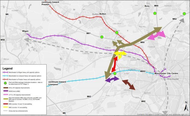

THE large map above displays the initial stage one proposals for the optimised in-corridor pacakge.
Each of the coloured lines represents a different element of the plan.
Here is a guide of what they all mean:
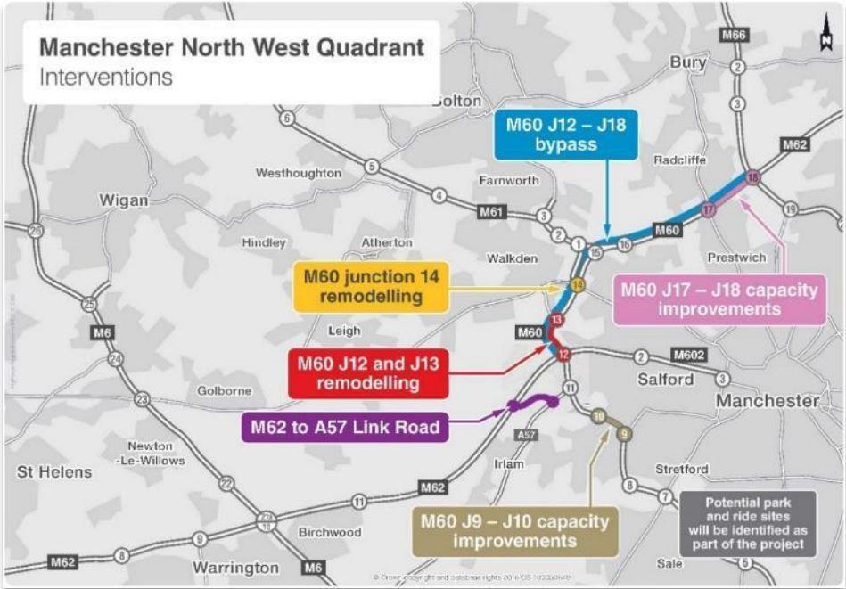
Long brown arrow
The longest arrow on the map displays the proposed bypass road between junctions 12 and 18 of the M60.
This is the part of the proposals which is most likely to affect Kearsley if given the green light.
It is hoped the link road would relieve pressure and traffic on that particular stretch of the M60 — which runs from Eccles to Simister Island, via Worsley, Kearsley, Clifton, and Whitefield.
Purple arrow
The purple arrow relates to a proposed link road in the Eccles area, which would link the M62 directly to A57 Liverpool Road, close to Salford Red Devils’ AJ Bell Stadium.
Short brown arrow
This is described as capacity improvements between junctions 8 and 9 of the M60 - close to the Trafford Centre. There is no further information about how exactly the capacity will be increased at this stage.
Short pink arrow
This is described as capacity improvements between junctions 17 and 18 of the M60 - near Whitefield.
Yellow arrow
The yellow arrow relates to the remodelling of junction 14 of the M60, close to Worsley. This may be necessary due to the construction of the bypass.
Red arrow
Relating to the remodelling of junction 12 and 13 of the M60, near Winton.
Green spots
Indicative locations of park and ride schemes to be delivered with the package.


Comments: Our rules
We want our comments to be a lively and valuable part of our community - a place where readers can debate and engage with the most important local issues. The ability to comment on our stories is a privilege, not a right, however, and that privilege may be withdrawn if it is abused or misused.
Please report any comments that break our rules.
Read the rules here