


In an age of drone cameras and Google Earth, it is difficult to imagine the impact of seeing your street and neighbourhood from above in less technologically advanced days.
It's a fact that the first aerial photograph appeared in 1858 (taken from a tethered balloon over the Bievre Valley in France) but for decades, getting a bird's eye view was a rare experience.
Those working in the military or government were among the privileged few to get such views, but, occasionally, the-then Bolton Evening News somehow managed to chart the changing face of the borough from above in photographs.
Today, we share a few of the photographs from our archives...
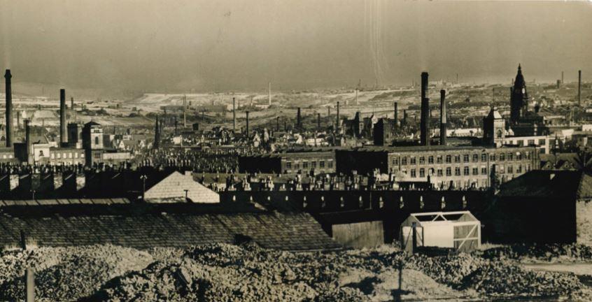
PICTURE 1 is a panoramic view from 1933 looking towards Farnworth and Kearsley from a viewpoint near the junction of Church Road and Elgin Street.
It was taken using an infra-red photographic process to cut through the mist which hung over the area.
The most familiar features are the Parish Church and Town Hall. To the left of the former can be seen St Mary's Schools, and tower of the Co-op drapery building.
In front of the Parish Church can be seen Mossfield Mill in Vernon Street, with its distinctive chimney.
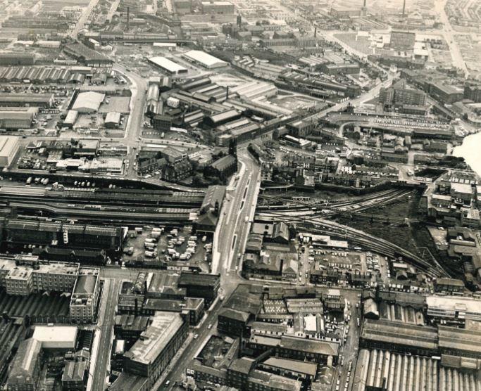
PICTURE 2 has Trinity Street and Bolton's railway station as the focal points in 1972. The old station was pulled down in the redevelopment shortly afterwards.
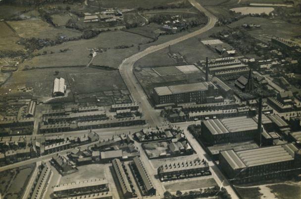
PICTURE 3, again from 1933, was taken from the top of the Fire Station looking north-east over Bradshaw to Affetside.
In the foreground are the works and other buildings between Bark Street and the rear of the GPO. Behind these, on the left, is the rear of St George's Road Congregational School and Church, with the tower of St George's Church beyond. Dobson's works are to the left of the church tower.
On the extreme right is Bridge Street Methodist Church, with the Co-op's drapery stores to its left, and one of Knowle's Peel Mills beyond.
Left again is the rear of St Mary's School, with the turret of Clarence Street Council School overtopping it.
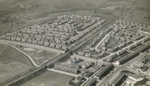
PICTURE 4 was taken just one year before the outbreak of the Second World War. It shows Hall i'th Wood estate. Through the centre runs the Bolton/Blackburn railway line.
PICTURE 5 is a view of Astley Bridge and the new Crompton Way taken in 1929.
It shows the junction of Blackburn Road, Crompton way and Belmont Road, and was taken by a newspaper photographer "flying in an Avro plane with Mr Kent, who is arranging popular passenger flights from Lostock Lane, and providing many thrills".
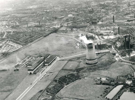
PICTURE 6 is a tale of two types of chimneys; mills and Back o'th Bank power station in 1965.
PICTURE 7, which resembles toy town houses, was taken in October 1954 and shows part of the Breighmet Hall housing estate. The principal roads are Withins Lane (bottom of the picture) and Winchester Way. The Top o'th' Brow estate can be seen in the distance.
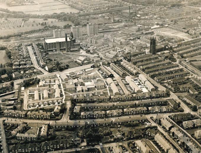
PICTURE 8 is a 1972 view of Deane. It shows St Saviour's Church, and the-then new flats at The Pocket. Bolton School can be seen top left.
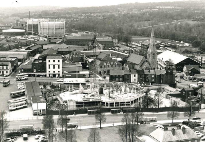
PICTURE 9 is of special interest to those on the wrong side of the law as it shows construction work on Bolton's new £4 million Crown Court in 1980.


Comments: Our rules
We want our comments to be a lively and valuable part of our community - a place where readers can debate and engage with the most important local issues. The ability to comment on our stories is a privilege, not a right, however, and that privilege may be withdrawn if it is abused or misused.
Please report any comments that break our rules.
Read the rules hereLast Updated:
Report this comment Cancel